

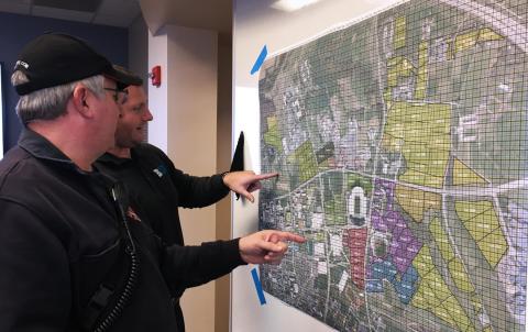
When fans are tailgating before a Penn State home football game, they are standing on an invisible safety grid that helps first responders to pinpoint any location within more than 1,900 acres of pastures and paved lots.
Thanks to a new coordinate grid system developed by Penn State geographers, Penn State University Police and Public Safety and State College police, any 12.5-yard square location can be efficiently communicated to first responders by use of a simple alphanumeric code. The grid overlays a series of maps of the parking lots that surround Beaver Stadium and were compiled into a booklet.
Subtitle
Collaboration with University Police and Public Safety yields tailgate grid map
Read the Full News Story